
Back to ancestor search
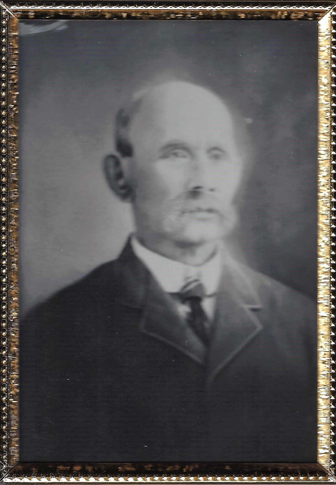
John Coleman

John Coleman

Born
1848-02-16 12:00:00
Died
1917-08-01 12:00:00
Gender
Male
Place of migration
Migrated to /Born in Canada

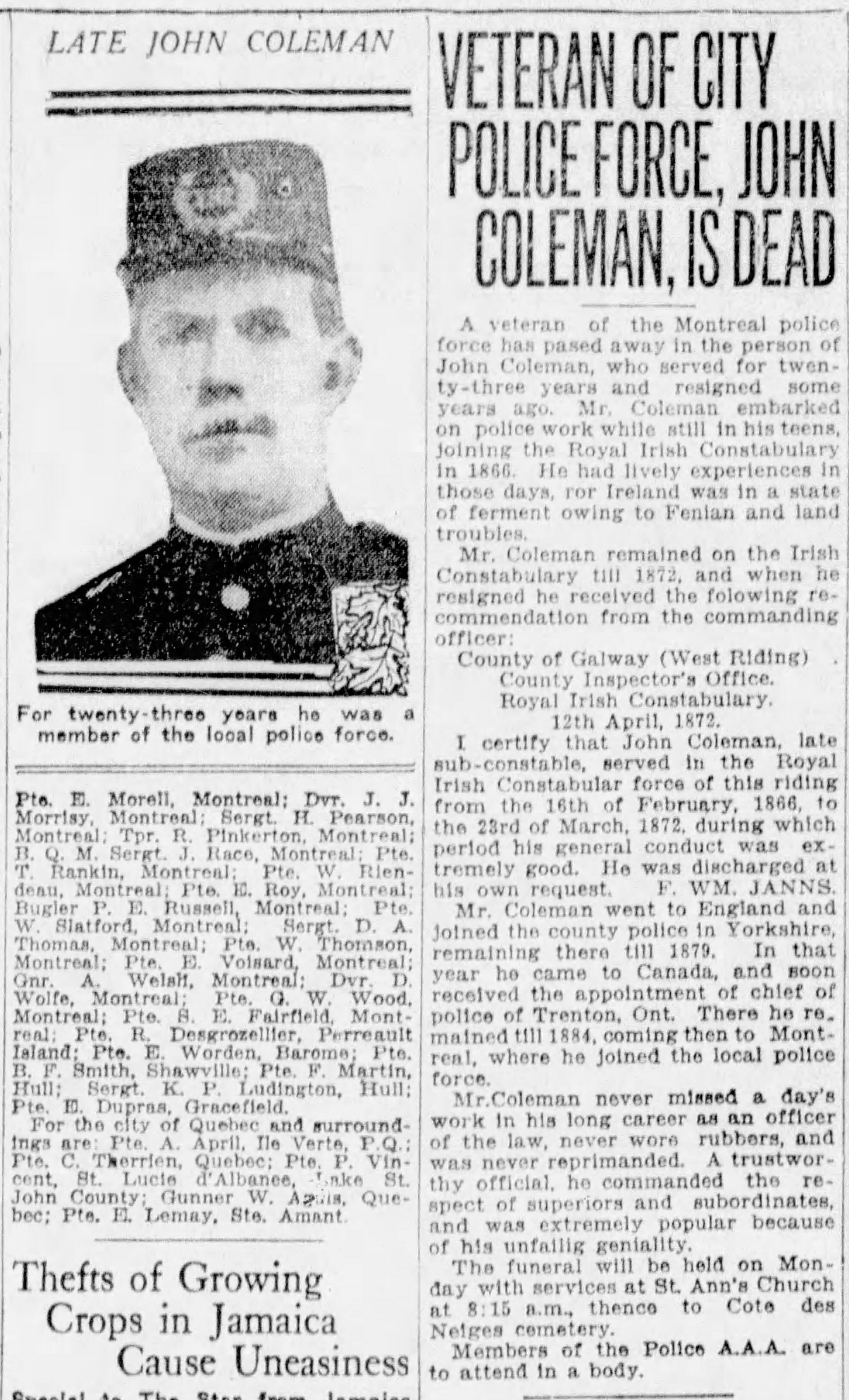
I live near Toronto in Canada and am descended from a Great Grandfather (John Coleman, sometimes spelled JNO) who came here from Ireland (by way of England) in 1879. He was born between 1845 and 1850.
We believe he was from Ballaghaderreen, County Roscommon but before 1898 it was in County Mayo. He was a policeman in Ireland 1866 to 1872 and we think he was the only child of Michael Coleman, a farmer.
We don’t know his mother’s name or if he had siblings. We assume, since we know of no siblings and she isn’t in census records, that she died in childbirth for John. It was during the famine years so it’s likely correct.
John was a police officer in Ireland (RIC), near Galway then later in Liverpool and then Yorkshire (1877-79) before marrying Anne Eliza Shaw from Yorkshire (Muston) and emigrating to Simcoe ON in Canada in Jan 1879. His firstborn was my grandfather William Francis Coleman in Nov 1879. My father was William Michael Coleman and his brother was John Redmond Coleman (both born in Montreal 1911 and 1918). So, we think perhaps the name William and middle names Francis and Redmond may be honouring ancestors of John and Michael, perhaps one is the maiden name of his mother. My father used both names for my brothers.
We do know that John went to Ireland one last time, presumably to tend to his dying father for the last 3 months in 1903. (Oct to Dec). John resigned from the Montreal police force in order to make the trip.
Michael likely died in December 1903 before John’s return. In one of his RIC police records John stated he had previously worked for a James Coleman – as a Labourer (probably farming) and James was very possibly another relative. We don’t know anything about parish names or townlands. He did seem to spell the town name as “Ballaghaderine” and we thought this was a mis-spell or from Gaelic but perhaps it’s a subsection of the city Ballaghadereen ???
Here's a really confusing fact – John’s headstone in Montreal reads “A Native of County Clare Ireland”. His RIC police paperwork indicates Ballaghadereen (erine) as his birthplace in Ireland.
We think his widow made an error on the tombstone but there is no way to know. A search of County Clare records did not yield any success. Maybe on his deathbed Michael told John he was actually born in County Clare? Our best hope is that a DNA connection to a resident of Ballaghadereen would provide conclusive info on Michael, his wife and their respective ancestors. I’m still hoping this happens since public records haven’t helped.
Would appreciate any info you can provide from church records. It’s my understanding that before 1864 the birth records were kept only by the church, not the civic authority. Hopefully you can find a John and Michael Coleman in the right time period and can fill in any blanks for me.
If you are a member of the Ancestry website or have any relatives that are members please let me know their names. I can try to find them in the and work backwards to see if we have common family tree links or distant DNA connections.
Associated communities

Galway

County Galway, Gaillimh in Irish, is located in the Province of Connaught in the West of Ireland. We have a population of approximately 232,000 and look forward to assisting you in the search for your Irish ancestors. 

Other ancestors in this community

Buildings in this community

  • Kilcooly Church Ruins & Cemetery

    Location: Galway

    Kilcooly, Co. Galway, Ireland

  • Portumna Irish Workhouse Centre

    Location: Galway

    St Brigid's Road, Portumna, Galway, H53 EK74, Ireland

  • Portumna Friary

    Location: Galway

    Portumna Demesne, Co. Galway, Ireland

  • Portumna Castle & Gardens

    Location: Galway

    Portumna Demesne, Portumna, Co. Galway, Ireland

Timeline events in this community

  • 1830s

    Kilcroan in 1837

    <p>As described in Samuel Lewis' <em>Topographical Dictionary of Ireland</em> 1837.</p>

    1837-01-01 12:00:00

  • 1820s

    First Census of Inisheer

    <p>The 1821 Census of Inisheer survived the Public Records Office fire. </p>

    1821-04-01 12:00:00

  • 1820s

    First Census of Inishmaan

    <p>The 1821 Census of Inishmaan survived the Public Records Office fire. </p> <p>Family names featured: </p> <p>Beaty</p> <p>O'Brien</p> <p>Callaghan, Callaughan, Collaughan</p> <p>Carey, Keaghry </p> <p>Clancy</p> <p>Concannon</p> <p>Connor</p> <p>Conneely (Connolly)</p> <p>Cook</p> <p>Costelloe</p> <p>Curreen</p> <p>Collins</p> <p>Dignum</p> <p>Dirrane (Derrane)</p> <p>O'Donnell</p> <p>Faherty</p> <p>Flaherty</p> <p>Fitzgerald</p> <p>Flemon (Fleming)</p> <p>Folan</p> <p>Ginnane</p> <p>Glinn (Glynn)</p> <p>Grealish, Grelish</p> <p>Griffy</p> <p>Higgins</p> <p>Joyce</p> <p>Kane, Kean, Kine</p> <p>Keating</p> <p>King</p> <p>Linnane</p> <p>Maher</p> <p>McDonough</p> <p>Mulkern (Mulkerrin)</p> <p>Murry (Murray)</p> <p>Prendergast</p> <p>Scahill</p> <p>Sullivan</p> <p>Welch</p> <p> </p>

    1821-04-01 12:00:00

  • 1830s

    Arranmore, Ennismain and Innishere in 1837

    <p>As described in the "Topographical Dictionary of Ireland" by Samuel Lewis, 1837</p>

    1837-01-01 12:00:00

Mayo

County Mayo, or Maigh Eo in Irish, is located in the west of Ireland.  We are home to Ashford Castle, Croagh Patrick and the fabulous town of Westport.  Our county town is Castlebar and we have a population of approximately 130,000.  We look forward to helping you connect with your ancestors’ place of origin.

Other ancestors in this community

Buildings in this community

  • St Marys Church, Curraghmore, Bofeenaun, Co. Mayo

    Location: Mayo

    Curraghmore, Bofeenaun, Co. Mayo

  • Workhouse Belmullet, Mayo, Ireland

    Location: Mayo

    Belmullet, Co. Mayo, Ireland

  • Knockmore RC Church

    Location: Mayo

  • Old National School, Lisaniska, Mayo

    Location: Mayo

    Foxford F26 EY28

Timeline events in this community

  • 1830s

    Kilcoleman Costello in the 1830s

    <p>A snapshot of pre-famine local history, as described by Samuel Lewis in the "Topographical Dictionary of Ireland" 1837.</p>

    1837-01-01 12:00:00

  • 1820s

    Kildavnet Freeholders List

    <p>A unique Census Substitute for the townland of Carrickkildavnet aka Kildavnet in 1829. This Freeholders List can provide useful information about those who held enough land to register to vote. While the smaller tenant farmers who suffered most during the Great Famine won't appear on this list, there may be a few surprises included here (that didn't appear on Tithe applotment records). These could be partners on a freehold lease. Can you find your ancestor's name below?</p>

    1829-06-01 12:00:00

  • 2020s

    Moses Keady/Kedey pre 1827

    <p>I am looking for ancestors across both Mayo and Donegal Parish for name Kedey, Keady (sp). Specifics below in text.</p>

    2022-01-01 12:00:00

  • 1830s

    Night of the Big Wind

    <p><a href="https://www.irishcentral.com/roots/history/night-of-the-big-wind-ireland-1839">https://www.irishcentral.com/roots/history/night-of-the-big-wind-irelan…</a></p>

    1839-01-06 12:00:00

Roscommon

County Roscommon, or Ros Comáin in Irish, is located in the western region of Ireland. We are home to the stunning Lough Key Forest Park and statistically, we are known to have the longest life expectancy of any county in Ireland! We look forward to helping you connect with your ancestors’ place of origin.

Other ancestors in this community

Buildings in this community

  • Ballaghaderreen TOWN PLAN

    Location: Roscommon

    Ballaghaderreen, Co Roscommon, Ireland

  • Ballaghaderreen TOWN

    Location: Roscommon

  • Pre-1840 Tenant Map of Drumbrick, Glooria, Drumanilra, Gortleck, and Cloonkeen

    Location: Roscommon

    Cavetown, Croghan, Boyle, Co Roscommon

  • Carrowmore Tenant Map 1818

    Location: Roscommon

    Carrowmore, Croghan, Co Roscommon

Timeline events in this community

  • 1830s

    Kilcoleman Costello in the 1830s

    <p>A snapshot of pre-famine local history, as described by Samuel Lewis in the "Topographical Dictionary of Ireland" 1837.</p>

    1837-01-01 12:00:00

  • 1740s

    Elphin Census of Tibohine Parish

    1749-01-01 12:00:00

  • 1760s

    Religious Census of Killukin, Creeve & Tumna

    <p>In March 1766, the Irish House of Lords instructed Church of Ireland parish clergy to compile ‘a list of the several families in their parishes’ – to record the religion of the householders and to identify any Roman Catholic priests and friars living in their area. Although most of the original 1766 religious census returns were destroyed Dublin's Public Records Office fire of 1922, a few fragments survived.</p>

    1766-04-15 12:00:00

  • 1760s

    Religious Census of Killummod

    <p>In March 1766, the Irish House of Lords instructed Church of Ireland parish clergy to compile ‘a list of the several families in their parishes’ – to record the religion of the householders and to identify any Roman Catholic priests and friars living in their area. Although most of the original 1766 religious census returns were destroyed Dublin's Public Records Office fire of 1922, a few fragments survived.</p>

    1766-03-01 12:00:00