Back to ancestor search
Michael Griffen

Michael Griffen

Born
1892-09-18 12:00:00
Died
1920-11-14 12:00:00
Gender
Male
Place of migration
Stayed in Ireland

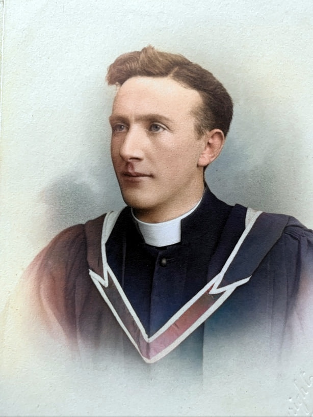
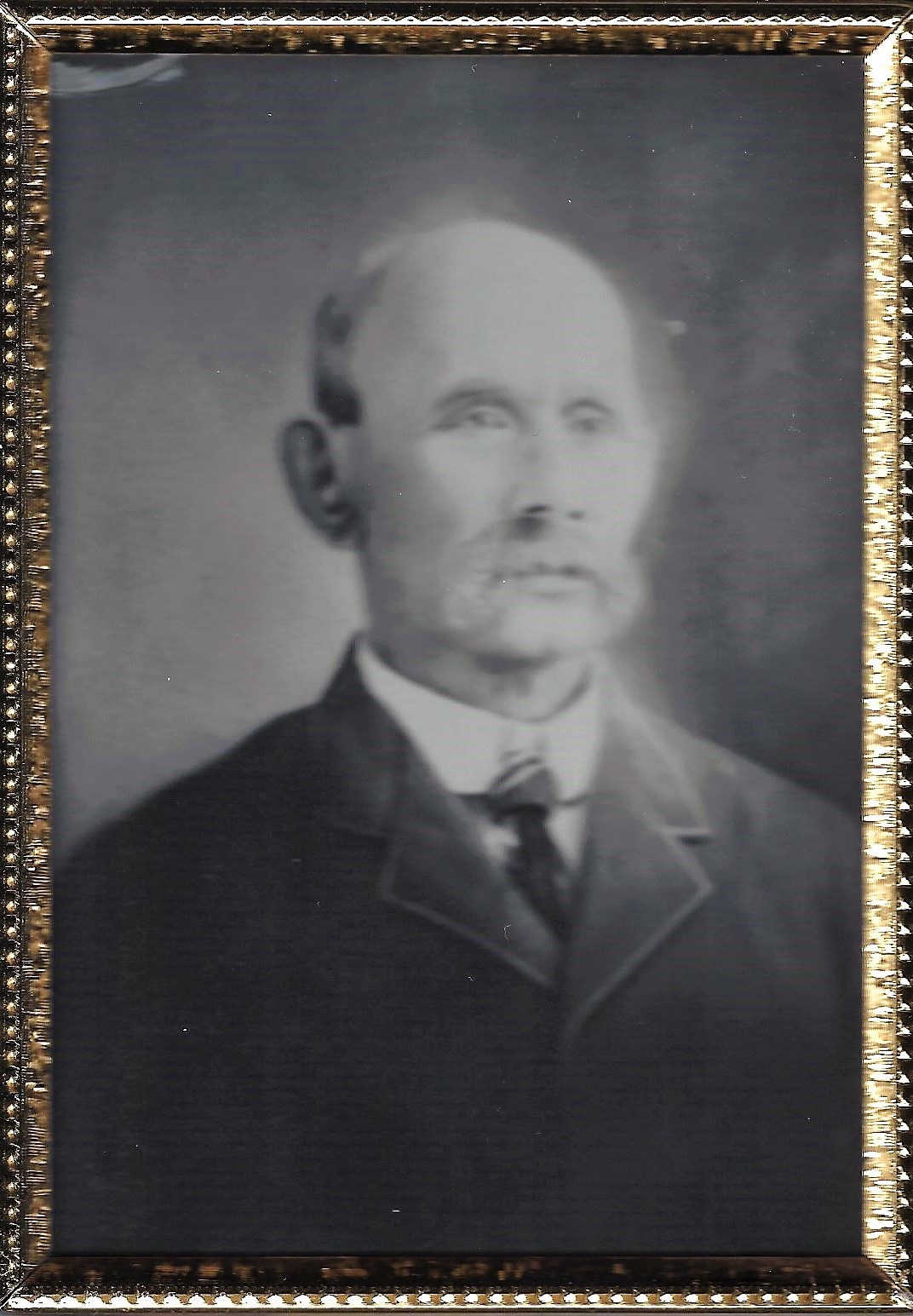
Father Michael Griffin (1892 – 1920) for whom the "Father Griffin's" GAA club and Galway's "Father Griffin Road" was named, was a young Catholic priest believed to have been killed by the Black & Tans in reprisal during the Irish War of Independence. A native of the parish of Clonkeen in East Galway, he served as a curate in the parish of Ennistymon, Co. Clare, before being transferred to Rahoon, Galway City in 1918. His father having long been associated with Parnell and the Land League, young Fr Griffin was a known Irish republican sympathiser. Taken from his home to Lenaboy Castle for questioning on the night of 14 November 1920, he never returned. On 20 November, his body (with a gunshot to the head) was found in an unmarked grave in a bog at Cloghscoltia near Barna. Such was the public outcry, 3 bishops, 150 priests and over 12,000 mourners made up the cortege at his funeral. He was interred in the grounds of Loughrea Cathedral. A memorial stands in Bearna today, on the spot where his body was found.

Father Griffin Road

Black and Tans

Charles Stewart Parnell


ALSO READ
Associated communities

Galway

County Galway, Gaillimh in Irish, is located in the Province of Connaught in the West of Ireland. We have a population of approximately 232,000 and look forward to assisting you in the search for your Irish ancestors. 

Other ancestors in this community

Buildings in this community

  • Kilcooly Church Ruins & Cemetery

    Location: Galway

    Kilcooly, Co. Galway, Ireland

  • Portumna Irish Workhouse Centre

    Location: Galway

    St Brigid's Road, Portumna, Galway, H53 EK74, Ireland

  • Portumna Friary

    Location: Galway

    Portumna Demesne, Co. Galway, Ireland

  • Portumna Castle & Gardens

    Location: Galway

    Portumna Demesne, Portumna, Co. Galway, Ireland

Timeline events in this community

  • 1830s

    Kilcroan in 1837

    <p>As described in Samuel Lewis' <em>Topographical Dictionary of Ireland</em> 1837.</p>

    1837-01-01 12:00:00

  • 1820s

    First Census of Inisheer

    <p>The 1821 Census of Inisheer survived the Public Records Office fire. </p>

    1821-04-01 12:00:00

  • 1820s

    First Census of Inishmaan

    <p>The 1821 Census of Inishmaan survived the Public Records Office fire. </p> <p>Family names featured: </p> <p>Beaty</p> <p>O'Brien</p> <p>Callaghan, Callaughan, Collaughan</p> <p>Carey, Keaghry </p> <p>Clancy</p> <p>Concannon</p> <p>Connor</p> <p>Conneely (Connolly)</p> <p>Cook</p> <p>Costelloe</p> <p>Curreen</p> <p>Collins</p> <p>Dignum</p> <p>Dirrane (Derrane)</p> <p>O'Donnell</p> <p>Faherty</p> <p>Flaherty</p> <p>Fitzgerald</p> <p>Flemon (Fleming)</p> <p>Folan</p> <p>Ginnane</p> <p>Glinn (Glynn)</p> <p>Grealish, Grelish</p> <p>Griffy</p> <p>Higgins</p> <p>Joyce</p> <p>Kane, Kean, Kine</p> <p>Keating</p> <p>King</p> <p>Linnane</p> <p>Maher</p> <p>McDonough</p> <p>Mulkern (Mulkerrin)</p> <p>Murry (Murray)</p> <p>Prendergast</p> <p>Scahill</p> <p>Sullivan</p> <p>Welch</p> <p> </p>

    1821-04-01 12:00:00

  • 1830s

    Arranmore, Ennismain and Innishere in 1837

    <p>As described in the "Topographical Dictionary of Ireland" by Samuel Lewis, 1837</p>

    1837-01-01 12:00:00

Clare

County Clare, or An Clár in Irish, is located in the mid-west region of Ireland.  Clare is known for its beautiful scenery and we are home to the famous Burren and Cliffs of Moher.  We have a population of approximately 117,196.  We look forward to helping  you connect with your ancestors’ place of origin.

Other ancestors in this community

Buildings in this community

  • Morrissey Cottage

    Location: Clare

    Ballyvergin, Clare, Ireland

  • Mullins Ancestral Home

    Location: Clare

    Gortaficka, Crusheen, Co. Clare

  • Inagh VILLAGE

    Location: Clare

    Inagh, Ennis, Co. Clare

  • Sileshaun East TOWNLAND

    Location: Clare

    Sileshaun East, Maurice’s Mills, Inagh Co. Clare.

Timeline events in this community

  • 1830s

    INAGH and DYSERT in 1837

    <p>There is no Lewis Topographical Dictionary entry for INAGH. It says "see Dysert":</p>

    1837-01-01 12:00:00

  • 1910s

    Grandfather played for County Clare

    <p>In December 2015, my father told me his father played football for Clare, after asking him the name of the town his parents were from.</p>

    1916-09-30 12:00:00

  • 1910s

    1917 All Ireland Senior Gaelic Football Final

    1917-12-09 12:00:00

  • 1830s

    Ennis 1832 - Cholera

    <p>This was originally published as part of a post 'Epidemics Across the Years' on my blog at <a href="https://pastlinks.blogspot.com.au">https://pastlinks.blogspot.com.au</a></p>

    1832-08-16 12:00:00

Clonkeen (Galway)

Our aim is to connect all people with a link to Clonkeen (Galway). You may live here, have visited here or maybe are tracing ancestors who left long ago. In any case, we’re sure to have lots to share and are delighted to welcome you.

Other ancestors in this community

No other ancestors are associated with this community.

Buildings in this community

No buildings are associated with this community.

Timeline events in this community

No timeline events are associated with this community.

Rahoon (Galway)

Our aim is to connect all people with a link to Rahoon (Galway). You may live here, have visited here or maybe are tracing ancestors who left long ago. In any case, we’re sure to have lots to share and are delighted to welcome you.

Other ancestors in this community

Buildings in this community

  • St Anne's Child & Adolescent Centre

    Location: Rahoon (Galway)

    St Anne's Child & Adolescent Centre, Rahoon, Co. Galway

  • Hill House

    Location: Rahoon (Galway)

    Hill House, Rahoon, Galway city

  • National Piscatorial School

    Location: Rahoon (Galway)

    Claddagh Quay, Galway, County Galway

  • Thatched Cottge, The Claddagh, Galway City

    Location: Rahoon (Galway)

    The Claddagh, Galway

Timeline events in this community

  • 1880s

    Foundation of Rahoon-Newcastle GAA Club

    1889-01-01 12:00:00

  • 1770s

    Moycullen to Oughterard Map

    <p>Taylor &amp; Skinners "Maps of the Roads of Ireland" pub. 1778 recorded castles, big houses and other landmarks of interest that were in ruin or still extant at that time.</p>

    1778-01-01 12:00:00

Ennistymon (Clare)

Our aim is to connect all people with a link to Ennistymon (Clare). You may live here, have visited here or maybe are tracing ancestors who left long ago. In any case, we’re sure to have lots to share and are delighted to welcome you.

Other ancestors in this community

Buildings in this community

  • Ennistymon Workhouse

    Location: Ennistymon (Clare)

    Ennistymon Community Hospital, Co. Clare

  • The Old Tollhouse ENNISTYMON

    Location: Ennistymon (Clare)

    Ennistymon Bridge, Ennistymon, Co. Clare

  • Moga's Lane off Bogberry St ENNISTYMON

    Location: Ennistymon (Clare)

    Bogbere Avenue, Ardnacullia North, Ennistymon, Co. Clare

  • Griffins Bar ENNISTYMON

    Location: Ennistymon (Clare)

    Bogbere, Ardnaculla North, Ennistymon, Co Clare.

Timeline events in this community

  • 1840s

    Ennistymon in 1845

    <p>As published in The Parliamentary Gazeteer of Ireland, 1845</p>

    1845-01-01 12:00:00

  • 1970s

    St John's Eve ENNISTYMON

    <p>Gathering in Ennistymon for St. John's Eve traditional bonfire 1974.</p>

    1974-06-23 12:00:00

  • 1830s

    Ennistymon aka Ennistimon in the 1830s

    <p>A snapshot of pre-famine local history, as described in the "Topographical Dictionary of Ireland" by Samuel Lewis, 1837. (The information collected here was submitted by members of the local gentry and clergy of the time).</p>

    1837-01-01 12:00:00

  • 1830s

    County Clare in the 1830s

    <p>A snapshot of pre-famine local history, as described in the "Topographical Dictionary of Ireland" by Samuel Lewis, 1837. (The information collected here was submitted by members of the local gentry and clergy of the time).</p>

    1837-01-01 12:00:00

Michael Griffen